

First sight of the eruption
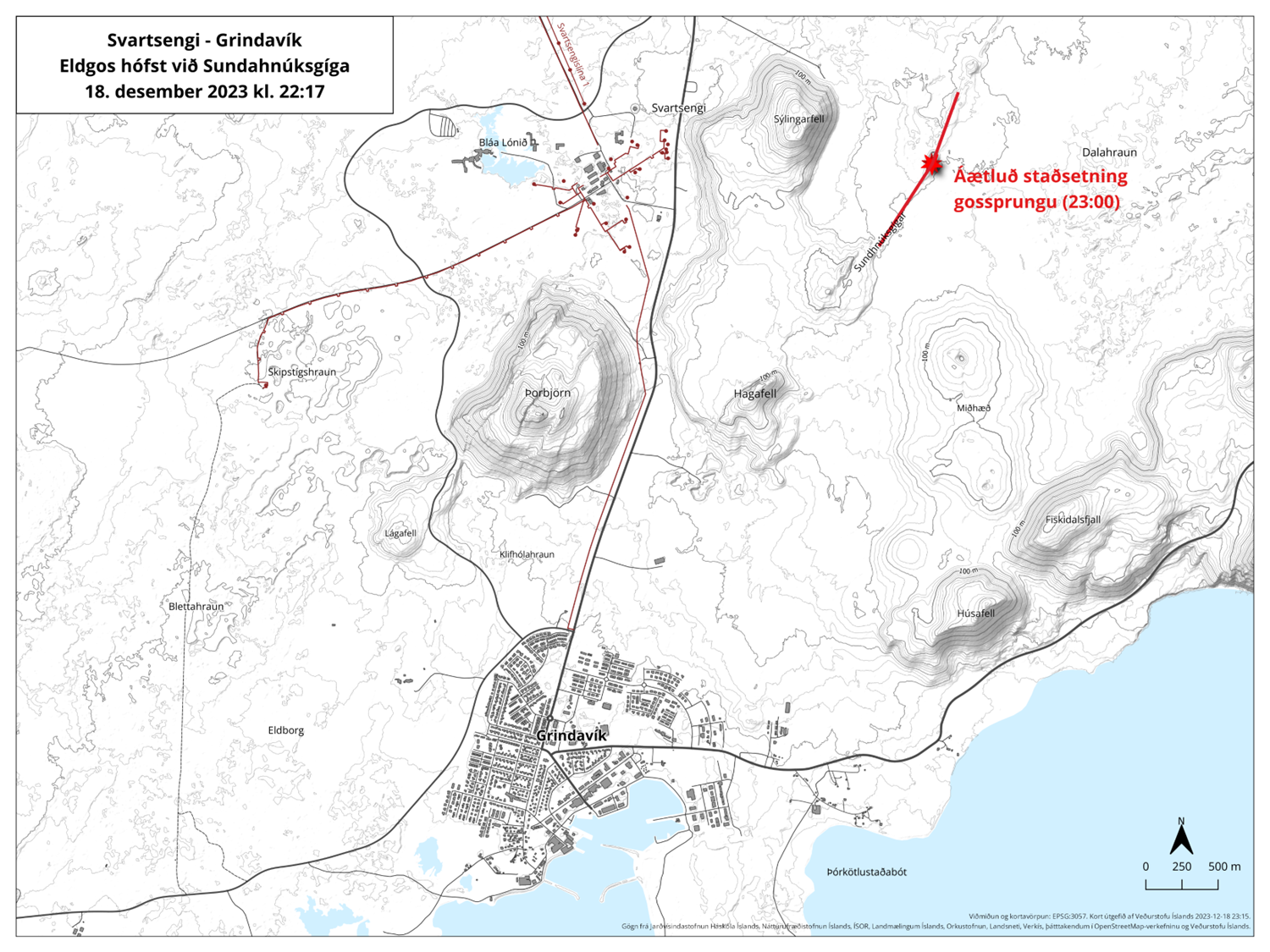
At 22:17 on 18 December, a volcanic eruption commenced north of Grindavík on the Reykjanes peninsula. The eruption site, situated along the Sundhnúkagígar crater line and approximately four kilometres northeast of Grindavík, is currently visible on nearby web cameras.
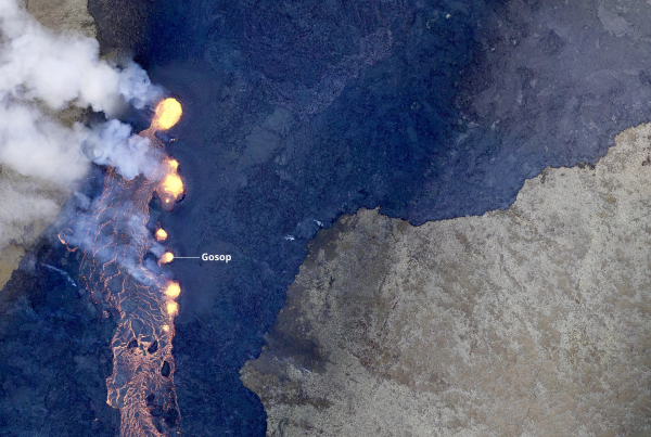
The fissure, extending close to 4 km (2.5 mi) in length, has resulted in lava flow primarily heading northward, which is a positive development for the safety of Grindavík. We are closely monitoring the situation to provide timely updates.
Following an earthquake swarm that began at 21:00, Almannavarnir captured the eruption’s development from a Coast Guard helicopter soon after the eruption started. These images are crucial for our ongoing analysis and understanding of the event.
For the most current and reliable information regarding this significant geological event, we encourage you to visit The Icelandic Meteorological Office website for accurate and detailed updates on volcanic activity. Additionally, travellers planning to visit or currently in Iceland can find essential safety information at Safe Travel Iceland. Stay informed and prioritize safety during your travels.
We are pleased to report that, despite a brief closure, the airport has reopened and is operating as usual. We continue to prioritize safety and are working diligently to keep the community and travellers informed.
Ongoing Developments in the Reykjanes Peninsula Eruption
19 December 09 am

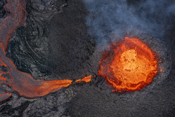
Lava strokes from the erupting fissure. Photo: Almannavarnir
The volcanic eruption that commenced at 22:17 on December 18th on the Reykjanes Peninsula continues to evolve, presenting new geological phenomena. This eruption is taking place along the dyke intrusion identified in November. In the initial hours, it was characterized by intense activity, with lava discharge rates estimated in the hundreds of cubic metres per second. The most vigorous lava fountains were observed at the northern end of the fissure.
As the eruption progresses, lava is spreading laterally from the fissure. This activity is accompanied by significant ground deformation, a vital indicator of the ongoing geological processes, as evidenced by real-time GPS measurements.
Notably, since the early hours of December 19th, there has been a decrease in seismic activity around the eruption site. This, along with assessments of the fissure’s development, suggests that the eruption’s intensity has lessened since its onset.
Despite the decrease in seismicity, the situation remains critical. The eruption poses potential risks to the nearby communities, including Grindavík. Access to the town has been restricted, and all roads leading to the eruption site are closed to ensure public safety and facilitate scientific evaluations.
The Icelandic Meteorological Office, in collaboration with civil protection and response units, is diligently monitoring the eruption. A meeting of scientists is scheduled this morning to analyze the latest developments and plan accordingly.
The public is advised to stay informed through official channels and adhere to safety guidelines. This event underscores the dynamic nature of our island, and it is essential to approach it with caution and respect for the potential risks involved.
