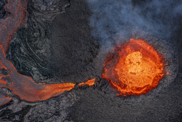
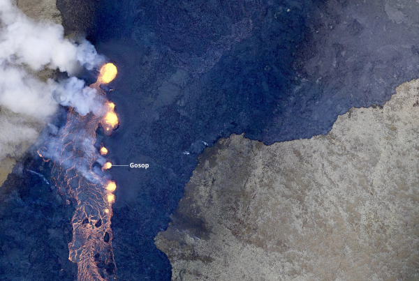
The eruption NE of Mt Fagradalsfjall continues. The lava eruptions is now concentrated in a large, boat-shaped crater made of welded lava lumps from lava fountains. Four to six vents are visible in the crater lava pool. The current lava discharge is 13 cubic metres per second. The lava flow has a total area of in excess of 0.4 square kilometres with a volume of about 3.7 million cubic metres, according to scientific institutions monitoring events. The magma type is basalt melt, originating in the top section of the mantle at a depth of up to 20 kilometres, underneath the crustal rocks. The lava heads to the south and has reached the Meradalir lava flow from August 2022.
Hikers have to access information on conditions prior to any attempt to hike some 20 km (both ways) to the site.
Safe Travel Iceland is the best place to get information regarding access to the area. Visit Reykjanes also has some good information.
The hosts at LAVA Centre can also give all the information needed.
Map: Grindavíkurbær